Using imagery in the combine
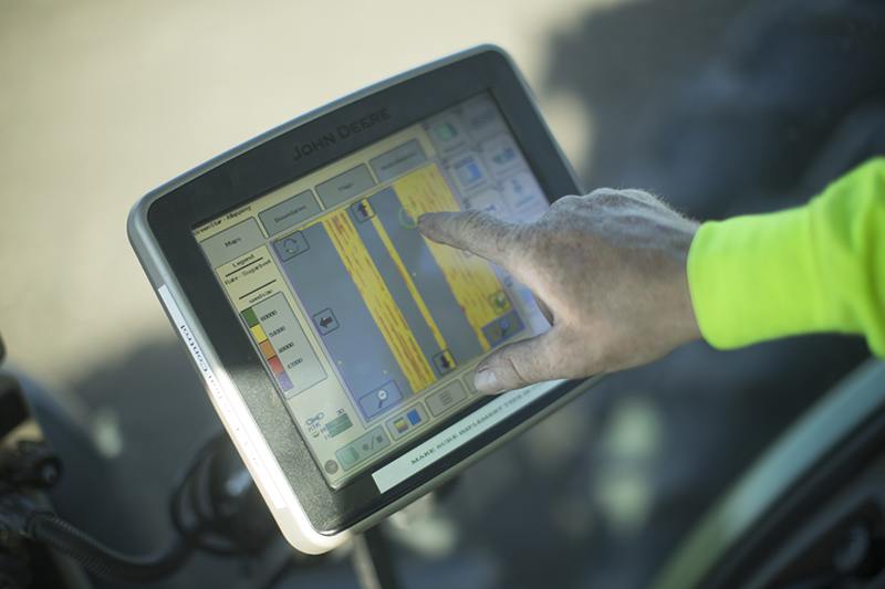
Imagery is used in a variety of ways in agriculture, from planning to in-season monitoring. Another use for imagery that many overlook, however, occurs in the combine. Analyzing archive imagery, like yield potential maps or in-season images, while harvesting compares yield results to insights gleaned throughout the season.
Advances in ag technology enable growers to export images to multiple programs, such as Google Earth, so it’s possible to ground truth and compare actual field conditions to their corresponding imagery. “For example, growers can correlate the areas producing the most yield to peak biomass images from corn in July that show the highest NDVI value,” WinField’s Brittany Ullrich says.
Using imagery can help growers better understand their current and previous field conditions. This information is invaluable for future planning and yield optimization. In some cases, it’s not possible to change the variability within a field with drainage or tile management. “But satellite imagery coupled with quality yield data can help identify zones throughout a field,” Ullrich adds. Each zone should be managed differently to help maximize yield and capitalize on inputs.
Imagery is used in a variety of ways in agriculture, from planning to in-season monitoring. Another use for imagery that many overlook, however, occurs in the combine. Analyzing archive imagery, like yield potential maps or in-season images, while harvesting compares yield results to insights gleaned throughout the season.