Nutrient Management, Meet Satellite Imagery
Making the most of your nutrient applications means applying nutrients in the right spot at the right time. With lower commodity prices on the horizon, it’s important now more than ever to plan for this precise management.
In my territory, farmers use grid sampling to help identify the highest-yielding areas of a field. Surprisingly, it often reveals that these highest-yielding areas are most deficient in nutrients. This is because the more yield an acre produces, the greater the demand for those nutrients to be replaced. Years of straight-rate applications or off-target variable rate applications have built fertility in historically low yielding areas and caused higher-yielding areas to become deficient.
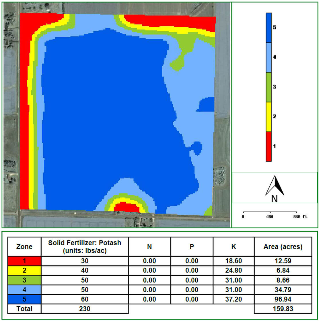
One of the best solutions to address this challenge is to make sure nutrients are returned to their proper place in the field. Satellite imagery can help ensure you pinpoint the exact locations that need replenishing. Here are two examples:
To find out how to use satellite imagery and the R7® Tool to formulate variable rate plans for your operation, contact your local WinField representative.
In my territory, farmers use grid sampling to help identify the highest-yielding areas of a field. Surprisingly, it often reveals that these highest-yielding areas are most deficient in nutrients. This is because the more yield an acre produces, the greater the demand for those nutrients to be replaced. Years of straight-rate applications or off-target variable rate applications have built fertility in historically low yielding areas and caused higher-yielding areas to become deficient.
One of the best solutions to address this challenge is to make sure nutrients are returned to their proper place in the field. Satellite imagery can help ensure you pinpoint the exact locations that need replenishing. Here are two examples:
- Images can be used to identify where farmers should vary or redistribute a total amount of fertilizer across the field to account for deficiencies.
- Satellite imagery can be used as a crop removal factor in any fertilizer. Knowing specifically where crops have removed nutrients helps farmers manage more effectively.
To find out how to use satellite imagery and the R7® Tool to formulate variable rate plans for your operation, contact your local WinField representative.