Get a Bird’s-Eye View of Your Fields

With the growing season well underway, it’s time to focus on how crops are faring in the field. Are weeds taking over? Have insects or disease arrived? Are crop nutrient levels adequate? An efficient way to monitor crop progress is with in-season imagery.
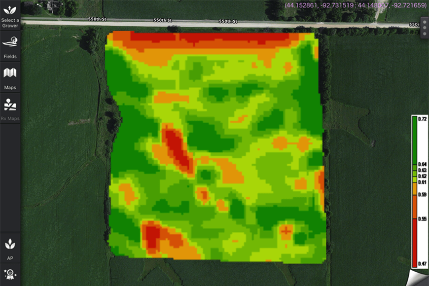
Viewing satellite images of your fields allows you to observe what’s happening and check progress against your production plans for the season. Crop biomass levels in the images can reassure you that crops are on track or pinpoint areas trending downward that need immediate attention. With the guidance of in-season imagery, you can quickly put boots to the ground, assess pending situations and make treatment decisions to protect input investments.
Tech Tool Enhancement
In-season imagery connects many new ag technology tools that have been introduced by WinField United, including the R7® Tool. By providing critical, up-to-date crop information, this imagery fuels not only immediate crop decisions but can also help you formulate plans for harvest, postharvest and next season.
The Field Monitoring Tool, which is fully integrated with the R7® Tool, allows users to quickly access agronomic information as they move from field to field. Using a multi-field dashboard, farmers receive current updates to help plan their day and increase productivity. In-season imagery helps with site-specific scouting, tissue sampling or an in-season variable-rate nutrition plans.
Before harvest, in-season images can be converted to a Yield Potential Map that can be used with the Profitability Map function to determine cost-effective areas of each field for the year. With this information in hand, you can make appropriate changes in your management style for the coming season to improve performance and bottom-line returns.
End-of-Year Insights
At the end of the season, don’t miss out on the pre- and postharvest benefits of satellite imagery. For example, in the South, in-season imagery can be used to help farmers decide if a defoiliant is needed for cotton or soybean crops to speed up the harvest process. After harvest, imagery can help identify broadleaf or winter annual weed outbreaks, giving you an opportunity for targeted fall herbicide treatments to keep fields clean going into spring.
Work with your local retailer and agronomist to put this useful tool to work in your operation throughout the season and beyond.


