4 Steps to Pairing Apps for a Scouting Home Run

As crops continue to grow, we’re all looking for ways to protect our investment. There are many apps at your fingertips, and pairing them often affords more benefits than using them independently. For example, using the R7® Tool, NutriSolutions® tissue testing, Climate FieldView Pro™ and Google Earth together gives you the ability to make in-season field diagnostics a home run.
1. Start with in-season imagery (ISI)
Available through the R7® Tool, ISI indicates plant biomass within the field, allowing you to take a more direct approach to diagnosing issues. By identifying low, medium and high areas of biomass, you can go directly to trouble spots and see what is occurring.
2. Add Google Earth
By exporting ISI to Google Earth (remember to turn on your device location services), you can watch yourself walk through the field until you are in the area you are looking for. This unique way of using ISI is a capability unlike any other available on the market today.
3. Diagnose issues
Once you have reached the area in the field you want to examine, the best way to diagnose what is occurring is to pull a tissue sample and have it evaluated. The new and updated NutriSolutions 360® app allows you to fill out the information on your tablet or phone, scan the code on the test bag, and submit the details to the lab without leaving the field.
4. Track scouting progress and take notes
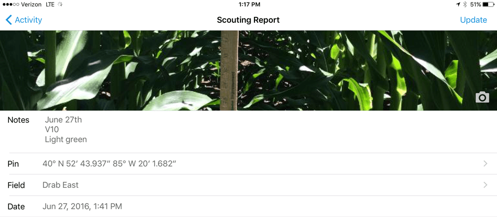
Finally, a great way to keep track of where you have been is to use the the Climate FieldView Pro™ app, which allows you to “drop pins” within the field map and take notes and/or pictures of what is happening. As a result, the next time you go out to look at the field, you will be able to go back to the area you were in previously and note any changes. Another advantage of using the Climate FieldView Pro™ app is that you can see the notes you have left attached to the pins when you’re in the cab driving through the field.
![]()
To get more in-depth details about how to use all of these applications in your operation, call your local ag technology specialist today.
1. Start with in-season imagery (ISI)
Available through the R7® Tool, ISI indicates plant biomass within the field, allowing you to take a more direct approach to diagnosing issues. By identifying low, medium and high areas of biomass, you can go directly to trouble spots and see what is occurring.
2. Add Google Earth
By exporting ISI to Google Earth (remember to turn on your device location services), you can watch yourself walk through the field until you are in the area you are looking for. This unique way of using ISI is a capability unlike any other available on the market today.
3. Diagnose issues
Once you have reached the area in the field you want to examine, the best way to diagnose what is occurring is to pull a tissue sample and have it evaluated. The new and updated NutriSolutions 360® app allows you to fill out the information on your tablet or phone, scan the code on the test bag, and submit the details to the lab without leaving the field.
4. Track scouting progress and take notes
Finally, a great way to keep track of where you have been is to use the the Climate FieldView Pro™ app, which allows you to “drop pins” within the field map and take notes and/or pictures of what is happening. As a result, the next time you go out to look at the field, you will be able to go back to the area you were in previously and note any changes. Another advantage of using the Climate FieldView Pro™ app is that you can see the notes you have left attached to the pins when you’re in the cab driving through the field.
To get more in-depth details about how to use all of these applications in your operation, call your local ag technology specialist today.

